Note: Inflatable PFDs (life vests) are not acceptable for paddling on RICKA Flatwater trips or Blackstone Valley Paddle Club trips.
Our trip organizers have the right to put restrictions on their trips. They may require specific boat lengths or boat types, spray skirts, headlamps etc. The trip may specify experienced paddlers only. Please make your decision to participate accordingly. This is for the safety and enjoyment of the entire group.Schedule:
Please review the
Safety Signals
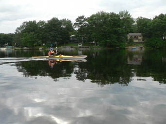
May 26th Big River {rain date of May 27th} Meet at 10:00.
Leaders: Henry Dziadosz hdziadosz@verizon.net 401-567-0313 home and Louise Price weezrad@aol.com
Bring a lunch.
Erik's video on the Big River
Trip is not suitable for kayaks over 15 feet. Narrow and twisty river. Paddle upstream against the current and then return with the current to the put-in.
Zeke's Bridge state access. N41 39 906 - W071 37 115
558 Harkney Hill Rd. Coventry
The Big River is accessed at this put-in.
Directions from 95 South.. Take exit 6 To Rt. 3 north ( DO NOT take exit 6-A which is Hopkins Hill Road) Take a right at the bottom of the exit and follow 3 North for about a mile and a half. Take a left onto Harkney Hill Road. Follow for a little over a mile and look for the access for Zekes Bridge.
Directions from 95 North, Take exit 6 to Rt. 3 north. ( DO NOT take exit 6-A which is Hopkins Hill Road) Take a left at the bottom of the exit and follow 3 North for about a mile and a half. Take a left onto Harkney Hill Road. Follow for a little over a mile and look for the access for Zekes Bridge.
Changes and cancellations to trips will be posted on the flatwater message board.
Please check the board before leaving for any trip. Our leaders provide directions as a courtesy to paddlers however, you are responsible to refer to a map and familiarize yourself with the trip location.
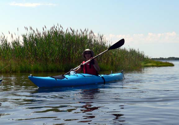
June 2nd Wood River Route 165 to Wyoming Dam
Leader: Sharon Dragon shdrag1@gmail.com 401-225-3942.
Shuttle leaves at 10:00.
Bring a lunch.
The beginning of the river may be narrow, shallow and rocky but soon opens up.
Trip is approximatley 7 miles long.
41° 34.375' N 71° 43.259' W
See this location in: Google
Maps Map
Server Acme
Maps
From 95 southbound take exit 5A (102
south). 1 mile to junction of route 3 south, bear right onto 3 south. 1
1/2 miles further to junction of 165 west. Take a right on 165
(west) for about 4 miles (estimated) to state ramp on the left.
From 95 northbound take exit 4 and take a right onto route 3 north at
the end of the exit. Go approx 4 miles north on route 3 to junction of
165 west. Take a left (west) on 165 about 4 miles (estimated) to state
ramp on the left.
Changes and cancellations to trips will be posted on the flatwater message board.
Please check the board before leaving for any trip. Our leaders provide directions as a courtesy to paddlers however, you are responsible to refer to a map and familiarize yourself with the trip location.
Bring a lunch
Slatersville Reservoir North Smithfield RI
This trip provides a nice paddle through a flatwater section of upper Slatersville Reservoir and then a stretch of the Branch River.
GPS Coordinates: N41 59. 243 W071 36.073
2890 Broncos Highway, Burriville, RI
Directions from North: From 146 South, take the Slatersville exit.
Take a right off the ramp onto Great Road/Victory Highway. Travel approximately 1.5 miles. Go straight through the light, continuing on Victory Highway (Route 102), and travel another mile. You'll see a DEM sign for the Slatersville Boat Launch on left-hand side. Park in the dirt lot on the left (adjacent to the Slatersville Fishing Club Parking Lot). If you get to the Burrillville town line you have gone too far.
Directions from South: From 146 North, take the Slatersville Exit. Make a left off the ramp onto School Street. Travel 1.25 miles and merge (left) onto Greene Street. Travel straight on Greene St. (which becomes Main St.) for another 1.25 miles. Take a left onto Victory Highway (Route 102). Less than ¸ mile on left is a DEM Sign for Slatersville Boat Launch. Park in the dirt parking area on the left- hand side. If you get to the Burrillville town line you have gone too far.
Changes and cancellations to trips will be posted on the flatwater message board.
Please check the board before leaving for any trip. Our leaders provide directions as a courtesy to paddlers however, you are responsible to refer to a map and familiarize yourself with the trip location.
Leader: Aaron Correia ackayaking@gmail.com www.acyaking.com
Aaron will be flying his drone and taking pictures with it, while we paddle down the Snake River.
Bring a lunch.
Put-in location: Lake Sabbatia Public Boat Ramp, 1399 Bay St. Taunton, Massachusetts
Directions to Put-in: Take exit 9 off 495 North or South, depending on your location. Turn south on to Bay St and travel for one mile till you have reached the parking area for the Lake Sabbatia boat ramp. Ample parking for 20+ cars.
Shuttle: There will be no shuttle. We will put-in and take-out at the same location.
Added Bonus: I will be creating a video of our trip for all to view, which will be recorded using on-boat video cameras and aerial drone technology.
The aptly-named Snake River is so beautiful that I'm amazed that it doesn't seem to be listed in any guidebook. It flows from Winnecunnet Pond in Norton to Sabbatia Lake in Taunton.The Snake meanders with countless hairpin turns through the vast (over 16,000 acres) Hockomock Swamp. The river for the most part is smooth and dark, but the hue seems to come from silt, not pollution. At its mouth, it is pond like and clear. Further upstream it sometimes becomes quite narrow, but relatively unobstructed.
The vegetation on the banks consists of shrubs and swamp maples, farther back are majestic old growth forests. When paddling up river starting from Sabbatia Lake, paddling through the old forest will lead to the narrowest section of the river which cuts through the swamp. A maze of swampy wetland streams eventually lead you to the start of the river at Winnecunnet Pond.
We will paddle as far up the steam as possible given our group size, and water levels in the swamp area. It is possible to pass fully through the swamp to Winnecunnet Pond which would extend our round trip to around the 4 hour mark. If we must turn at the swamp, the round trip will be closer to 3 hours. There are a few spots along with river which will allow for paddlers take a pit stop, if needed.
At the half way point of the river, there is an old steel girder bridge which crosses a few feet above water level. This will either require you to lay flat in your kayak or canoe to paddle under, or will require an easy portage around the bridge.
We can take a snack break at the girder bridge to allow for portages and pit stops.
Linked below are a map showing our trip, and multiple videos I have taken at Snake River.
Map: https://drive.google.com/open?id=1__t_vvcB7ccQcdZRVBersQWxJ_s&usp=sharing
Snake River Videos:
Snake River: https://www.youtube.com/watch?v=x3cK7JGb980&t=2s
Snake River: https://www.youtube.com/watch?v=-9tFGKV8oFA&t=
Upper Snake River: https://www.youtube.com/watch?v=5b2slg77di4
Half of Snake River from Lake Sabbatia: https://www.youtube.com/watch?v=Xy8oJcQvIOg&t=
Changes and cancellations to trips will be posted on the flatwater message board.
Please check the board before leaving for any trip. Our leaders provide directions as a courtesy to paddlers however, you are responsible to refer to a map and familiarize yourself with the trip location.
Organizers: Erik Eckilson eckilson@cox.net 401-765-1741 and Cheryl Thompson 401-497-5887 or stonefoxfarm@juno.com
The RICKA Flatwater Group will be holding a Basic Flatwater Paddling Class on Saturday, June 16th at 1:00 at the EMS Outdoor School on Late Pearl in Wrentham, MA.
Class size is limited to 25 paddlers, and attendance is on a first-come, first-serve basis. In this 3-hour class, paddlers will learn the basic strokes and maneuvers to control their boats on flatwater. We will also practice basic rescue techniques.
The class will be taught by longtime RICKA member and EMS Kayak School Manager Joe Sherlock. Joe is an ACA Level IV Open Water Coastal Kayaking Instructor.
For more additional information contact Cheryl Thompson at stonefoxfarm@juno.com or Erik Eckilson at eckilson@cox.net
Changes and cancellations to trips will be posted on the flatwater message board.
Please check the board before leaving for any trip. Our leaders provide directions as a courtesy to paddlers however, you are responsible to refer to a map and familiarize yourself with the trip location.
Shuttle leaves promptly at 10;00
A beautiful and clean river.
Suitable for all boats and levels of experience.
A beautiful and clean river. shuttle
From Points north, take exit 3B off RTE 95. Continue for 1/2
mile to light where RTE 138 and RTE 3 join. Bear to the left and follow
straight for .9 of a mile to where RTE 138 turns west at a
blinking light. At this blinking light, turn left on to Mechanic St.
(Mechanic St becomes Hope Valley Rd.) The put in is
about 1 mile down this road on your left. The put in is near the over
pass of RTE 95.
N 41° 29.609 W 071° 42.957
Changes and cancellations to trips will be posted on the flatwater message board.
Please check the board before leaving for any trip. Our leaders provide directions as a courtesy to paddlers however, you are responsible to refer to a map and familiarize yourself with the trip location.
June 17th Charles River and Populatic Pond- Meet at 10;00 no shuttle required.
Leaders: Louise Price weezrad@yahoo.com and Frank Cortesa frankcortesa@charter.net 508-369-8205.
Bring a lunch.
Charles River & Populatic Pond- Norfolk to Medway/Franklin MA
GPS coordinates are: N 42 07.906 W 71 21.801
Suitable for all level of experience. The river is narrow and more suitable for boats 15 feet and shorter. Many twists and turns.
The Charles River affords canoeing, kayaking and fishing
opportunities in Franklin, MA, especially where the river moves
past picturesque Populatic Pond, a recreational body of water open to
non-motorized boating.

The pond connects to the Charles River and straddles the border
between the three adjacent Towns of Franklin, MA, Medway, MA and
Norfolk, MA. You can paddle down the Charles River onto Populatic
Pond or continue on the Charles as it moves downstream through the towns
of Medfield and Millis and beyond
Rt.495 North to exit 16 King St/Franklin. RIGHT onto King St. towards Franklin/Medway Go approx. 1.3 miles to a set of lights. Go straight thru and the road now becomes Chestnut St. Follow for approx. 2.9 miles and take a left onto Myrtle St. Go approx 1.4 miles and take left onto River Rd. Parking on side of road.
Those taking 495 south, same exit # but take a LEFT onto King ST.Changes and cancellations to trips will be posted on the flatwater message board.
Please check the board before leaving for any trip. Our leaders provide directions as a courtesy to paddlers however, you are responsible to refer to a map and familiarize yourself with the trip location.
June 18th Meeting on the Water- Canoe demos and lessons- free canoe rentals and lessons. {In the summer months we take to the water in leui of a meeting). Organizer: Erik Eckilson eckilson@cox.net 401-765-1741
We will meet at the Friends of the Blackstone and have use of their canoes and instruction!
Join us at Blackstone River Watershed Council/Friends of the Blackstone Environmental Center (100 New River Road, Lincoln, RI) as Erik Eckilson, Henry Dziadosz and Earl MacRae demonstrate how to paddle a tandem canoe. We will start with an on-shore demonstration, followed by coaching on the water. Bring a canoe if you have one, otherwise the Friends of the Blackstone will have canoes available for us to use. We hope to get everyone out on the water for a short trip down to the Albion Dam.
Changes and cancellations to trips will be posted on the flatwater message board.
Please check the board before leaving for any trip. Our leaders provide directions as a courtesy to paddlers however, you are responsible to refer to a map and familiarize yourself with the trip location.
June 23rd Armada- paddle, party and optional geocaching on the River. From Alton to Bradford on the Pawcatuck River. Meet at Alton at 9:00 am. Leader is Chris Kracik Kracikcj@cox.net
Directions to Alton {where we meet):
The Alton fishing access on Rt. 91:
Directions: Rt. 95 to Exit 1 onto Rt. 3 south for 1.8 miles. At Rt. 216 go left onto Rt. 216. Follow RT 216 until it joins RT 91. At that point turn left on RT 91. Put-in will be on your left in a few miles.
N 41° 26.272 W 071° 43.355
Get a (Wooden) Leg Up with the Armada
Geocache and Paddle Description:
All are welcome even if you do not geocache!
Call me Ishmawolf. Some sixty months ago - having nothing particular to interest me on shore, I thought I would kayak about a little and see the watery part of the state. It is a way I have of driving off the stress of work and regulating the circulation. With a philosophical flourish Cato throws himself upon his sword; I quietly take to the kayak. There is nothing surprising in this. If they but knew it, almost all men in their degree, some time or other, cherish very nearly the same feelings towards the river with me. (With great apologies to Herman Melville)
Itinerary:
Gather at the Launch Point at Alton: 9am-10am.
We'll meet & mingle
and get ready for the paddle down the Pawcatuck River. Any last
minute instructions and cautions will be provided.
Anyone who is paddling will drop their vessel off at the launch point , and then drive their car down to the designated Take Out at Bradford Landing. We'll be sure some one stays behind to watch the vessels. We will shuttle the drivers back to the launch point. The last shuttle vehicle will leave the Take Out parking at 9:30am sharp!
Paddle down the Pawcatuck River, Approximately 10am-12pm
We'll put in on the down river side of the dam, and paddle down
the Wood River/Pawcatuck River.
The Event - Party by the shore: 12pm until 2pm
There is a
spot along the river inside the boundaries of Burlingame WMA
that is a canoe camp. We will put ashore there, and enjoy a
leisurely lunch. Everyone is responisble for their own lunch and beverages. We will eat, relax, and have a few
laughs. There is a rope swing, so maybe some swimming will be in
order. Feel free to stick around as long as you want!
If you do not wish to stay for the entire lunch, you are free to continue on down the river to the Take Out spot. Just be sure your car is left there.
Once again there will a Cookie Toss Challenge - exact details will remain a closely guarded secret until the day of the event - complete with prizes.
The Rest of the Journey: After lunch, we will continue paddling the Pawcatuck until we reach the take out location, at Bradford.
Additional Information:
This is a nice stretch of river to paddle (
see map here), and we should not have too many issues with blow downs or jams. There is one tricky spot (Waypoint C2 below). We will all rally there, and do this one vessel at a time. We will have experienced paddlers just downstream for any contingencies.Alton or {L1} is the launch location, and Bradford or { T1} is the takeout location. Total paddle distance is approximately 6 miles , and should take about 4 hours to complete (not including any time spent at the event). All paddlers are responsible for their own equipment, including a PFD and water cannons!
Especially the watercannons!
Changes and cancellations to trips will be posted on the flatwater message board.
Please check the board before leaving for any trip. Our leaders provide directions as a courtesy to paddlers however, you are responsible to refer to a map and familiarize yourself with the trip location.
June 30th Deerfield River RSVP required
Joint Flatwater/Whitewater Trip
Deerfield River – Charlemont, MA
Leader: Erik Eckilson eckilson@cox.net 401-765-1741
This 7-mile trip has flatwater, quickwater, and three short class I/II rapids. Moving water experience is required, as is a helmet and sprayskirt.
We will shuttle three hours after the start of the dam release. Check the Flatwater Message Board the morning of the trip for shuttle time. Please RSVP to Erik Eckilson eckilson@cox.net 401-765-174.Directions; ake the Mass Pike West, to Rt 91 north to Exit 26, RT 2 west for about 17 miles to the Indian bridge. Once your reach the Indian bridge take the right just before the bridge onto Zoar Rd. There is a sign there "Rowe/Monroe" also. Follow Zoar Rd. to the end. Make a left at the end and proceed under the RxR bridge. Continue on the road until you reach the bridge that passes over the Zoar Gap. The parking area just before this bridge on the right. The put-in is across the street under the bridge.
Changes and cancellations to trips will be posted on the flatwater message board.
Please check the board before leaving for any trip. Our leaders provide directions as a courtesy to paddlers however, you are responsible to refer to a map and familiarize yourself with the trip location.
Bring a lunch.
Jay Cronan access to Bradford on the Pawcatuck River. 41° 26.707' N 71° 40.873' W
Street address: 591 Alton Carolina Rd Charlestown, RI 02813Jay Cronan access on the Upper Pawcatuck to the take out at Bradford. This is a good access point for paddling on the upper
Pawcatuck River above the confluence with the Wood River..
|
Changes and cancellations to trips will be posted on the flatwater message board.
Please check the board before leaving for any trip. Our leaders provide directions as a courtesy to paddlers however, you are responsible to refer to a map and familiarize yourself with the trip location.
Free for Current RICKA Members
Changes and cancellations to trips will be posted on the flatwater message board.
Please check the board before leaving for any trip. Our leaders provide directions as a courtesy to paddlers however, you are responsible to refer to a map and familiarize yourself with the trip location.
{In the summer months we take to the water in leui of a meeting).
Leader: Sharon Dragon shdrag1@gmail.com 401-225-3942.
At the launch we will paddle upstream (very little current) north and then turn around and return to the launch.
Alton fishing access on Rt. 91:
Directions: Rt. 95 to Exit 1 onto Rt. 3 south for 1.8 miles. At Rt. 216 go left onto Rt. 216. Follow RT 216 until it joins RT 91. At that point turn left on RT 91. Put-in will be on your left in a few miles.
N 41° 26.272 W 071° 43.355
Changes and cancellations to trips will be posted on the flatwater message board.
Please check the board before leaving for any trip. Our leaders provide directions as a courtesy to paddlers however, you are responsible to refer to a map and familiarize yourself with the trip location.
July 21st Ninigret Salt Pond
Leader: Sharon Dragon shdrag1@gmail.com 401-225-3942.
Launch at 10:30.
Bring a lunch.
Ninigret Pond, Charlestown
RI
Ninigret Pond is Rhode Island's largest coastal salt pond. The area features stunning landscapes and abundant coves for paddle craft to explore. It is also a great place to view wildlife. The area near the Charlestown Breachway (the outlet to the ocean) is dangerous for paddle craft and should be avoided because of both strong currents and heavy boat traffic. Otherwise, the pond is usually a calm and easy place to paddle. On most days the southwest wind fills in across this area in the morning and blows throughout the afternoon.
(Trip description courtesy of RI
Blueways Alliance
Directions from Blueways and modified by Jim
Cole.)
GPS coordinates to parking lot:
Directions:
Take Route 1 south to Charlestown,
going 2.3 miles past the junction of Route 1 and Route 2. After
going past Prosser Trail (Windswept Inn on corner), make a U-turn onto
Route 1 north, then bear right onto Route 1A (at the Tourist Information
sign) follow the Ninigret Park (a town park) sign on Route 1A for 0.5
mile and then turn right into the main entrance to the park (across from
Charlestown Police station).
The launch site is at the very end
of the main access road (about 1 mile down Park Lane). Follow the road
(Park Lane) left at the tennis courts, past the Frosty Drew observatory,
and then straight to the terminus of the road at the Grassy Point
parking area in the US Fish and Wildlife Refuge.
There is a
gravel road at the end of the parking area to drive down to the Kayak
Launch to unload your boats. Once unloaded, drive cars back to
parking area. There is also a rest room located at the parking
area. Parking available for 25 to 30 cars.
Changes and cancellations to trips will be posted on the flatwater message board.
Please check the board before leaving for any trip. Our leaders provide directions as a courtesy to paddlers however, you are responsible to refer to a map and familiarize yourself with the trip location.
July 22nd Wickford- Wilson Park- Leaders Erik Eckilson Erik Eckilson eckilson@cox.net 401-765-1741 and Earl MacRae. Meet at 10;00 earlandpat@comcast.net. 508-928- 2650 cell: 508-988-5589.
Bring a lunch.
Wilson Park boat ramp.
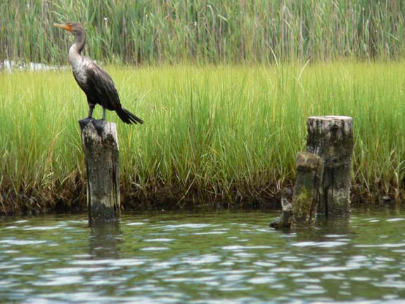
Paddle in the calm, wind-protected waters among the islands and marshes.
We will stop for lunch a swim at Cornelius Island.
A great opportunity to see osprey, great blue heron,
green heron, great egrets, cormorants, bufflehead ducks, and maybe a
deer or two.
Turn onto Intrepid St. from RT 1 (it's just North of the junction of RT 1 & 1A, near the fire & Police stations). Continue to the launch and the parking lot at the very end. NOTE: You can also get to the launch by going through the main entrance for Wilson Park from RT 1A, just South of the RT 1 & RT 1A junction, but it might be easier going the other way.
GPS N41 34.638 W071 27.187 Boat ramp
Changes and cancellations to trips will be posted on the flatwater message board.
Please check the board before leaving for any trip. Our leaders provide directions as a courtesy to paddlers however, you are responsible to refer to a map and familiarize yourself with the trip location.
Moonrise and sunset is at 8:10. Trip is suitable for all. Bring a headlamp or flashlight.
Directions to 47 Island Road, Norton MA. Take exit 11 off of RT 495 south. . Get off exit and immediately move into left lane to Reservoir Street. Go 0.7 tenths of a mile and take a right onto South Lakeview. Take a quick left onto Hawthorne. Your first right is Island Road, Lee's home is #47.
GPS coordinates are N 41 59.420 W071 11.792
Changes and cancellations to trips will be posted on the flatwater message board.
Please check the board before leaving for any trip. Our leaders provide directions as a courtesy to paddlers however, you are responsible to refer to a map and familiarize yourself with the trip location.
RICKA Adirondacks Trip 2018
Once again we will be paddling the waters of the Adirondacks State Park. The Adirondack State Park is comprised of 6 million acres.
Camping will be at Lake Eaton State Campground.
The dates will be August 4th – 11th, 2018. The trips we will be taking are suitable for any type of canoe or kayak. However, some of the longer trips are more suited to sea kayaks or touring canoes. As in the past, the trips will be decided on the night before. Camping reservations can be made atwww.reserveamerica.com . The sites we will try to focus on are from the 30's to the 50's.
Site capacity is limited to six people with a maximum of two tents. There are trailer sites available. Reservations can be made up to nine months in advance, but not a day before that.
The Adirondacks offers the finest flatwater paddling in our opinion. The variety of pristine paddling destinations in close proximity is unrivaled on the east coast. Other activities include hiking, biking and all other outdoor diversions. The Adirondacks Museum in Blue Mountain Lake is a great place to spend a rainy day. Lake Placid ant the Olympic attractions are about an hour’s drive and Tupper Lake has a wonderful Natural History Museum.
Weather can be “changeable”. Nighttime lows may drop into the forties and daytime highs can be in the nineties. Pop-up showers can occur at any time. If you have any questions or concerns e-mail Henry at hdziadosz@verizon.net
Meet at 10:00. Bring a lunch.
Sudbury River- Sudbury River: Shermans Bridge Rd Wayland, Mass to Egg Rock, Lowell Road, Concord MA-
Directions:
From RI/Mass state line on Route 95
North toward Foxboro/Boston. Go for 25.4 mi.
Take the left exit toward Portsmouth NH
onto I-95 N. Go for 15.1 mi.
Take exit 26 toward Waltham/Weston onto
US-20 (Weston St).
Keep left toward US-20 W/Weston/Wayland
and go over highway
and Go for 0.1 mi and bear right.
Continue on Weston St (US-20). Go for
5.0mi.
Turn right onto Concord Rd (RT-126). Go
for 3.6 mi.
Turn left onto Sherman Bridge Rd. Go for
0.4 mi.
Arrive at Sherman Bridge Rd.
Parking to the right on this wooden bridge.
O
r meet at Mansfield rest area on RT 95 about 3 miles north of Exit 5 leaving at 9:45 sharp. The facility is closed but parking and bathrooms are available. The Sudbury River is a nationally designated Wild and Scenic River. This section of the river Trail is both naturally and culturally interesting. You will find a wide and shallow river which is a natural undeveloped floddplain. Just downstream of the boat launch on Shermans Bridge Rd in Wayland you will enter Fairhaven Bay, a beautiful wide open section of the River, and an area written of by Thoreau and others. From here, the River loses some of its wide floodplains and becomes a bit more developed, traveling by the hospital and under Route 2. It is a gentle trip through the Town of Concord with a lot to see. The Trail concludes at the Old Calf Pasture, at the confluence of the Sudbury and Assabet Rivers, and a fun place to explore. You can take your boat out at the Lowell Road Boat Launch (on the right adjacent to the Calf pasture) or you can continue, either up the Assabet a short way or down the Concord to the Old North Bridge.Changes and cancellations to trips will be posted on the flatwater message board.
Please check the board before leaving for any trip. Our leaders provide directions as a courtesy to paddlers however, you are responsible to refer to a map and familiarize yourself with the trip location.
August 18th - Pawcatuck River- Bradford to Potter Hill Meet at 10:00 for a 10:15 shuttle.
Leaders: Chris Kracik Kracikcj@cox.net, Henry Dziadosz hdziadosz@verizon.net - home 401-567-0313 and Frank Cortesa frankcortesa@charter.net 508-369-8205..
Bring a lunch
Bradford access:
N41°24.370' W71°44.895'This section of the Pawcatuck River has plenty of deep water. We will paddle to the Potter Hill Take out approximately 7 miles.
95, R.I. to Exit 1 onto Rt. 3 south for 1.8 miles. At Rt. 216 go left (onto 216). Follow 216. Put in will be on the left shortly after a right turn where 216 merges with Rt. 91 (same road, two route #’s).
Changes and cancellations to trips will be posted on the flatwater message board. Please check the board before leaving for any trip. Our leaders provide directions as a courtesy to paddlers however, you are responsible to refer to a map and familiarize yourself with the trip location.
August 20th -Meeting on the Water- Narrow River note this replaces a meeting, in the summer months we take to the water in leui of a meeting)Tony and Aline Moore tsunamikayak@juno.com
Meet at Pollock Street at 6:00 pm.
Narrow River Narragansett RI
Directions: Take 95 South to exit 9 (a left exit) towards Newport/S. County. Merge onto Rt. 4 South. Turn slight right onto Tower Hill Road. Turn left onto Bridgetown Road (at large tower). Turn slight right onto Middlebridge road. Approximately a mile and half-mile up on the left will be Pollock Street. Turn and follow to the parking area. N41 28.044 W071 27.013
Parking for the Gilbert Stuart area launch is 815 Gilbert Stuart Road, Saunderstown, RI 02874
Changes and cancellations to trips will be posted on the flatwater message board.
Please check the board before leaving for any trip. Our leaders provide directions as a courtesy to paddlers however, you are responsible to refer to a map and familiarize yourself with the trip location.
Changes and cancellations to trips will be posted on the flatwater message board.
Please check the board before leaving for any trip. Our leaders provide directions as a courtesy to paddlers however, you are responsible to refer to a map and familiarize yourself with the trip location.
September 8th - Pawtuxet River - Warwick to the Cove
Meet at 10:00 for a shuttle.
Leaders: Bill Luther prijon@juno.com and Erik Eckilson eckilson@cox.net 401-765-1741 and Chuck Horbert chorbert13@gmail.com 401-418-2838
Bring a lunch.
From Route 95, take exit 12A to Route 113 East, Warwick. Go .6 miles then turn left onto Route 5 (North). Go .09 miles and take a right onto Knight Street (across Bridge after Greenwich Village). Go .07 of a mile until the river is on your right.
The put-in is on the curve at Knight Street next to the bike path and an old cemetery."
GPS N 041 43' 51.89" W071 27'. 43.81"
or 10 Knight Street Warwick RI
Changes and cancellations to trips will be posted on the flatwater message board.
Please check the board before leaving for any trip. Our leaders provide directions as a courtesy to paddlers however, you are responsible to refer to a map and familiarize yourself with the trip location.
September 15th- Bowdish Lake- Pat and Earl MacRae
earlandpat@comcast.net 508-928- 2650 cell: 508-988-5589. Meet at 10:00.
If there is someone at the gate, just tell them you are here to use the boat ramp and you will not be charged an entrance fee.
Bowdish Lake - Glocester RI
GPS put-in coordinates are: N41 55. 408' W071 45.493
From Worcester - Take Rt. 290 South until it becomes Rt.
395 South. Continue to Exit 97 in Putnam Connecticut for Rt. 44 East.
Follow Rt. 44 East for appox 7. 5 miles to G the George Washington
Camping area on your right. ( you will not be charged a day use fee). Go
into the campground and follow the one way signs for approx 1/4 mile.
From Rt. 146 South - Take Slatersville Exit. Turn right
onto Rt. 146 A. At light by Slatersville Plaza, go straight on Rt. 102
South. Follow Rt. 102 South for seven miles to intersection with
Rt. 44 in Chepachet. Turn right onto Rt. 44 West and continue
about four miles to the George Washington Camping area on your
right (you will not be charged a day use fee). Go into the
campground and follow the one way signs for approx 1/4 mile.
From Rt. 146 North - Take Slatersville Exit. Turn left
off ramp onto School Street. At intersection by Slatersville
Common and Church, veer left onto Green Street. Continue through
Slatersville to first light at Rt. 102. Turn left onto Rt. 102
South. Follow Rt. 102 South for six miles to intersection
with Rt. 44 in Chepachet. Turn right onto Rt. 44 West and continue
about four miles to the George Washington Camping area on your
right. ( you will not be charged a day use fee). Go into the campground
and follow the one way signs for approx 1/4 mile.
From Rt. 295 - Take 295 North or South to exit 7B Greenville, Route 44
west. Follow Rt. 44 West for approx. 13.5 miles to the George Washington
Camping area on your right. ( you will not be charged a day use fee). Go
into the campground and follow the one way signs for approx 1/4 mile.
Changes and cancellations to trips will be posted on the flatwater message board.
Please check the board before leaving for any trip. Our leaders provide directions as a courtesy to paddlers however, you are responsible to refer to a map and familiarize yourself with the trip location.
Meet at 12:30 for a 1:00 pm launch. For info on this trip; contact Cheryl Thompson at stonefoxfarm@juno.com or 401-497-5887.
This paddle is being offered by the Blackstone Valley Paddle Club for the Blackstone National Heritage Corridor's "Go Program" and is open to everyone.
Membership requirements are waived for this paddle.
Lincoln Woods state park.
Directions: Take the Twin River Road exit from route 146 and follow the signs. Turn right onto the ring road in the park ( you have to). Follow a few miles to get to the state boat ramp. Lincoln woods put in- boat ramp -
N 41 53 370 W 071 25 684
Our leaders provide directions as a courtesy to paddlers however, you are responsible to refer to a map and familiarize yourself with the trip
Please check the board before leaving for any trip.
Changes and cancellations to trips will be posted on the flatwater message board.
September 22nd -RICKA Picnic Click here!
Changes and cancellations to trips will be posted on the flatwater message board.
Please check the board before leaving for any trip. Our leaders provide directions as a courtesy to paddlers however, you are responsible to refer to a map and familiarize yourself with the trip location.
September 29th- Nashua River- Meet at 10:30. Trip leaders are Louise Price weezrad@yahoo.com and Frank Cortesa at frankcortesa@charter.net 508-369-8205.
Changes and cancellations to trips will be posted on the flatwater message board.
Please check the board before leaving for any trip. Our leaders provide directions as a courtesy to paddlers however, you are responsible to refer to a map and familiarize yourself with the trip location.
earlandpat@comcast.net 508-928- 2650 cell: 508-988-5589
|
Bigelow Hollow State Park off Route 171, 1.3 miles east of junction with Route 190. |
Changes and cancellations to trips will be posted on the flatwater message board.
Please check the board before leaving for any trip. Our leaders provide directions as a courtesy to paddlers however, you are responsible to refer to a map and familiarize yourself with the trip location.
Will Conrad meet at 10:00 for a 10:30 launch.
Changes and cancellations to trips will be posted on the flatwater message board.
Please check the board before leaving for any trip. Our leaders provide directions as a courtesy to paddlers however, you are responsible to refer to a map and familiarize yourself with the trip location.
Changes and cancellations to trips will be posted on the flatwater message board.
Please check the board before leaving for any trip. Our leaders provide directions as a courtesy to paddlers however, you are responsible to refer to a map and familiarize yourself with the trip location.
October 27th Halloween Paddle! Changes and cancellations to trips will be posted on the flatwater message board.
Chris Krajek
Please check the board before leaving for any trip. Our leaders provide directions as a courtesy to paddlers however, you are responsible to refer to a map and familiarize yourself with the trip location.
November 3rd- Turkey Paddle
Changes and cancellations to trips will be posted on the flatwater message board.
Please check the board before leaving for any trip. Our leaders provide directions as a courtesy paddlers however, you are responsible to refer to a map and familiarize yourself with the trip location.